And here it is:
The List
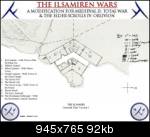
Below are listed, in no particular order, the streets of the great city of Darineth as they were named at the time of the Final War. Where necessary an explanation is given as to the name, and all names are given in English and Ilsamiren. This document refers to the map below which shows the quarters separately at this time. They will later be conglomerated in a final map and numbered as they are here. Currently the Temple Quarter is missing, as I have yet to draw it to a good enough standard. Much of it mirrors the Port Quarter however. An overview map is also shown below, which gives some indication of the final layout and shape of the city. Numbers 28 to 32 of the Port Quarter section refer to the Haven (the central quarter on the map).
The Palace and Military Quarters
1. The Great Way – Or Sedh Gail
2. Archers’ Lane – Id Glaihali’ath
3. Range Street – Eth Glion
4. Port Way – Sedh Glatir
5. The Southern Barracks Road – Orn Erim Herion Nomer
6. Southern Barracks Lane – Id Herion Nomer
7. Soldiers’ Southern Lane – Id Hali Nomeras
8. The Lords’ Paths – Orn Eri Heiruri’as
9. Soldiers’ Northern Lane – Id Hali Vimeras
10. Northern Barracks Lane – Id Herion Vimer
11. Temple Way – Sedh Leriya
12. The Northern Barracks Road – Orn Erim Herion Vimer
13. Stable Street – Es Thior
14. Knights’ Lane – Id Ralkiri’ath
15. The Palace Way – Or Sedh Elayir
The Port Quarter and the Haven Port
1. Guardhouse Lane – Id Duhaldh
2. and 4. Galuir Road – Erim Galuir – Galuir was the great smith who forged the first steel sword and armour for the King Ilahir I.
3. Tower of the Dividing Sea Way – Sedh Diler Orn Eris Laudhas
4. See 2
5. Sea Lane – Id Eris
6. and 23. Ilsem Road – Es Ilsem – Ilsem was the king to reorganise the entire trade system between the Southern Kingdom and Darineth.
7. First East Shortcut – Erisal Himer Arina
8. Second East Shortcut – Erisal Himer Ramudwe
9. and 12. Warehouse Street – Es Holedh
10. Eastern Thoroughfare – Igleth Himer
11. Garden Way – Sedh Tangwe
12. see 9
13. Second West Shortcut – Erisal Domer Ramudwe
14. Western Thoroughfare – Igleth Domer
15. Third West Shortcut – Erisal Domer Rafina
16. First West Shortcut – Erisal Domer Arina
17. Dockman’s Lane – Id Lathe (like “dock worker”)
18. , 24 and 27 – Smith’s Road – Erim Cefali’ath – a hub for blacksmithing activity.
19. , 20 and 21 – The Market Band – Or Figal Hiolsir – a triangle of roads around the market.
20. See 19
21. see 19
22. Ignore this
23. see 6.
24. see 18
25. Builders’ Road – Erim Navori’ath – a street where a concentration of builders has traditionally had their workshops and offices.
26. Shipwrights’ Road – Erim Yalori’ath – here are the offices and workshops of a number of old shipwright companies.
27. see 18
28. Channel Road – Erim Clomeni
29. South Haven Road – Sedh Prethan Nomer
30. Haven Dock Way – Sedh Lat Prethan
31. Haven Dock Lane – Id Lat Prethan
32. Hultir Street – Eth Hultir – Hultir contributed greatly to the security of the Clomeni Prethanas by proposing and then overseeing the construction of the great chains which are at either end of it.
This city will be recreated as closely as possible, allowing for some possible limitations of the MII engine. Ultimately I hope to present the city identically in both mods so the player will be able to experience both the perspective of an individual and a more cinematic overview of the city.


