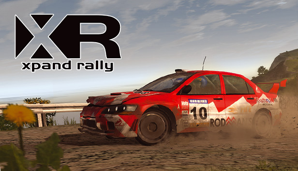
Xpand Rally means pure adrenaline! The photorealistic graphics combined with the dynamic driving model and interactive track surroundings make you feel as if you were really speeding through the woods on a narrow gravel road of a special stage... The game offers several single player modes for the fans of traditional WRC and Rally Cross. In addition to that one can choose from time trials or direct confrontation, single races and career mode as well as a couple of multiplayer modes. Xpand Rally also offers a wide array of car tuning options. The possibility of adjusting the individual car parts and gears before each rally enables you, if you choose so, to squeeze out additional horsepower from your car, decide on the suspension, balance the braking system, adjust the differential and gearbox... after all every split second counts. Excellent car physics model of Xpand Rally adjusts the car behavior in line with the mechanical parts specification, surface type and...
Description
This file is used to "grow" a grey scale road by x number of layers for blurring and eventual pasting into a height map.
Preview
Post a comment
Profile
Icon
Platforms
WindowsDeveloper
TechlandPublisher
Deep SilverEngine
Chrome Engine 2Contact
Send MessageHomepage
Xpandrally.comRelease date
Game watch
Follow
Purchase

Related Games
Xpand Rally
Racing
Related Engines
Chrome Engine 2
Proprietary
Related Groups

Deep Silver
Developer & Publisher

Techland
Developer & Publisher
Tags