The media you are trying to view has been deleted and is no longer available. This may have occurred at the uploaders request, or it may have occurred because it violated the sites Terms of Use. If this is a mistake and you would like it re-activated, please contact us with the details.
If you would like to view other media in this gallery click here.
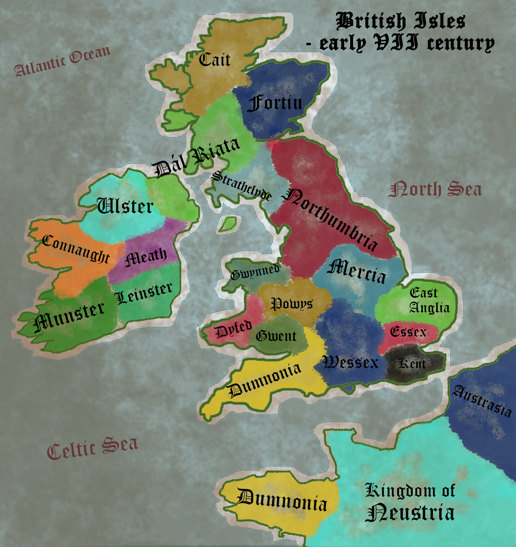
Ok, so I decided to do more maps! :) Here is the map of the British Isles in the early VII cetury.
- You can see the kingdoms of Angles, Saxons and Jutes start to unite, a goal wich they'll achieve in the IXc., in an attempt to respond to the viking invasions. Wessex and Essex were the Saxon kingdoms (West and East Seaxe), Kent was Jutish, the Northumbria and East Anglia were Anglish and Mercia was a mixture of them all.
- To the east of Anglo-Saxons laid the kingdoms and Duchies of Britons, the last remenats of the tribes that were conquered by the Romans in the I century. The Strathclyde, the Northernmost of these kingdoms, the Welsh duchies of Gwent, Powys, Dyfed and Gwynned and the Dumnonians on both sides of the English channel all belonged to this group.
- The modern-day France was controlled by the Franks, although they were not unified yet. The northern kingdoms of Neustria and Austrasia both fought for control of the region.
- The Scotland wasn't a thing yet. Untill the IX century the kingdoms of Picts (most notable being Cait and Fortiu) and the Dal Riata (consisting of Goedelic peoples of Irish origin) were separate realms.
- The Ireland, as always, was divided by clans and tribes. Ulster, Connaught, Munster, Leinster, Meath and Dal Riata were the bigger ones, although we lack sources so it isn't like they were the only ones there.