We're heading south, and it's getting warmer. Africa is in sight, so get ready for this map preview, because it's going to be a hot one.
And as always, Enjoy :D
Working from West to East, we make our first stop at the region of Mauretania Tingitana, named for the capital city of the region, Tingis.

Following the coastal road we end up in Mauretania Caesariensis. Much like its sister region to the west, Mauretania Caesariensis is named after the capital city of Caesaria.

Staying on the coastal road, we find ourselves crossing the border into Roman Numidia, whose borders are much different than those of the Kingdom of Numidia, defeated years earlier. The chief city of the region is Cirta.

A short ways to the east lands us in the first Roman province of Africa, hence the name of the province, Africa. This region was once ruled by the mighty city of Carthago. The city still stands strong, as depicted by the location of the region's port. Augustus named Utica the capital of the region.

Our final journey is a long one, as we following the coastal road once more across the great landmass of Africa, ending up in the region of Tripolitania, home to Lepcis Magna, once a great city of the Carthaginian Empire, still remains a dominate stronghold in Roman Africa.

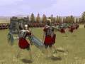
Africa is a large landmass with few points of supply. Heading any further south of these regions would be suicide, as only desert and heat await you, in the unconquerable land labeled Terra Incognita.
The rundown of the regions in Africa (in no particular order):
Africa (Utica)
Mauretania Tingitana (Tingis)
Mauretania Caesariensis (Caesaria)
Numidia (Cirta)
Tripolitania (Lepcis Magna)