Lost Dragons is a multiplayer total modification aiming to bring out a new thrilling gamemode for Arma3 . Our concept is futuristic objective based team warfare with randomly generated map elements to ensure every game is a unique experience with completely new set of units, weapons, structures and terrain.

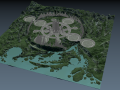
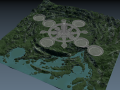
Updated the heightmap with the concept ideas and regenerated the textures. After doing this, got a wild idea of bringing the map mesh from L3DT to Blender and alas there were export tools for just that!
Map concepting is pretty much limited only by how much juice my rig has.. Its getting old I tell you. :9 Gotta start planning for an upgrade.
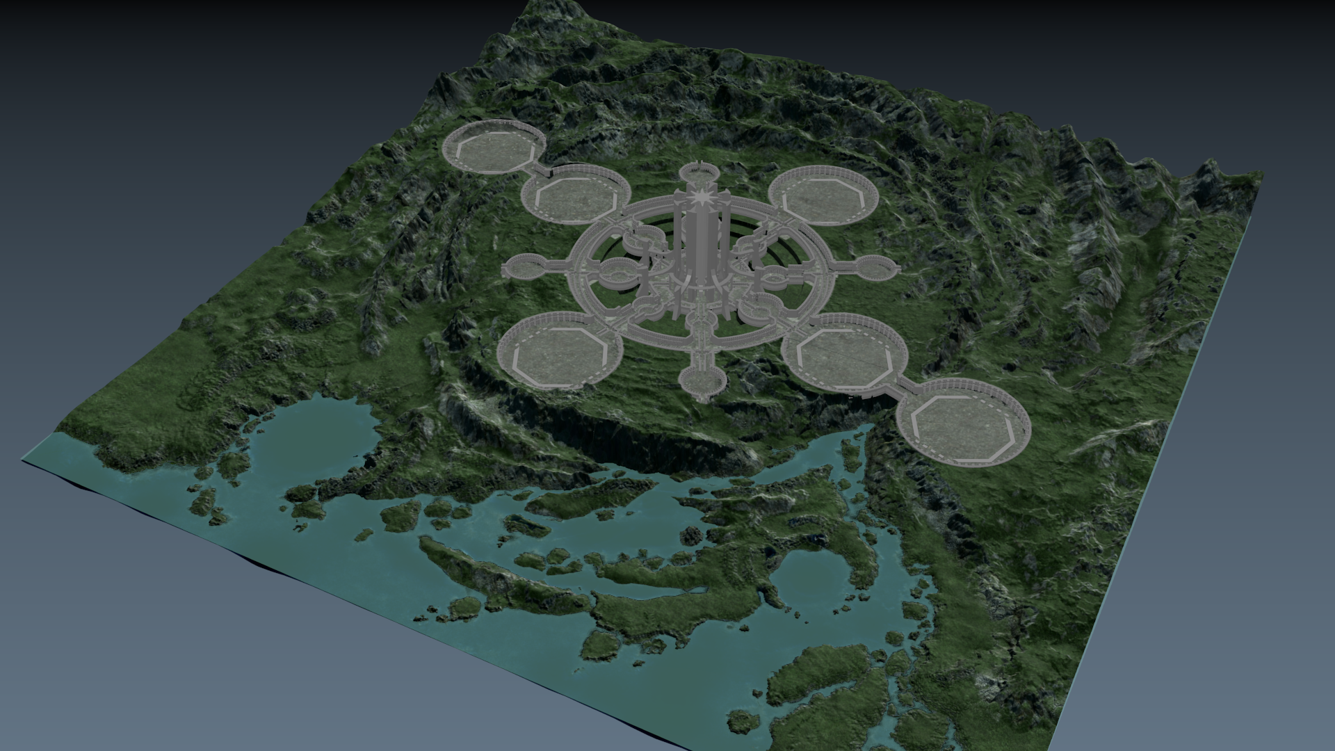
Anyhow, changes to the concept include more defined crater shape around the city and the surrounding mountains. I am thinkinh of raising the north side (water is to south) even higher to make the crater shape even more distinguished. It might be tad too even right now and I don't want to sink the city any further as I already have. The wall tops are almost at the ground level now and the "walls" are not supposed to be obstacles. Their main purpose is being the base for the city infrastructure.
Looking good! My man! Youtube.com
By the way the far left circle is pretty much at the edge of the map. How much space is there between? Seemingly that circle will be richly detailed as the others, however it's placement that close to the edge will determine the possibilities of the mission-makers. Especially if they want to use flying units. What do you think? You probably had these conversations with others, sorry if I force you to keep repeat yourself.
Hey! No one has actually asked. :D And even if someone had, please do ask if anything is unclear.
The distance to the map edge is about 500m, so not much I admit and flying so close to the edge is never too pretty. It is problematic I must admit and originally I had calculated the city to be smaller. Things tend to grow tho..
I have 2 options I have considered. First one being that I remove the 2 outermost Dragon Ark circles and replace them with smaller ones for different use. Fairly simple.
Second one, also my favorite one, is that I double the map size form 20x20 to 40x40 by adding 10km to the sides and 20km to the north. This however is still untested are because I would have to use 8192x8192 heightmap and while I've succeeded in importing and playing empty map with that heightmap size and same terrain resolution (5 meters) It is still unproven if it works in actual use.
From these I would prefer the second option, but the first one is not out of the question, if the map plays better that way.
I see, thank you!
1st.: Even if you would delete the far left circle, you should leave the right outermost, you'd still have the cross-layout.
2nd.: Sounds good, but what if you create a beach on that left side as well? As if this map were a peninsula.
Imgbox.com
Here is a quick sketch using your image. The white lines at the coast could be cliffs, Like here:
Travel-wonders.com
I rush to add, I love the crater-like deformation of the surface, and I am pretty sure the shape is important for the lore. And the islands are looking great too!
Thanks for the idea! Peninsula could be an alternative. But I kinda dislike the straight up north coastline though as it feels little too deliberate and it would shoot straight into the mountains maybe cutting them awkwardly. It would still need a bit more land on the west side to work I think.
Gameplay vise it would be wise choice. Like BI did with Chernarus. But it does not look very real.
Im still hoping (and dreading) the terrain size increase. (would mean 4 times the land to cover with stuff)
If I remove the other (or make it only a small habitat hub), I'll do the same to the other. I've been considering it also so that the Dragon Arks would all reside in the primary crater. It might be lore related thing.
Can you walk on the top of the middle tower? I can't really tell, but it seems as you could see beyond the west hills as you were standing atop the tower. So you could see "the vast feauterless meadows".
Another quick idea for the peninsula-argument. What if the water underwashed the whole structure of the furthermost west cirlce? So you could place it diagonally, thus from the second to left circle the road would slope downwards into scenic ruins.
Imgbox.com
So this method would spare several meters for you in horizontally. Moreover you don't need the remove the east circle, however you basically got rid of the west counterpart. And it even makes an interesting landmark for mission makers. We are talking about an abandoned city, right? :) I understand the hills would be still a bit of a problem. But now the production designer, and the dilettante mapper speaks from me as I have never built anything in Arma 3
Perhaps, have not considered it before. Changes on large scale like that would mean a lot more work and perhaps the whole northwest corner would have to be remodeled. An option if nothing else seems to work. The height difference between the city area and sea might be too much to actually sink under water the main city floor is about 500 meters above sea level.
The tower will be accessible yes and with clear weather and full view distance you might see the edges of the 20km map.
This is an engine limitation that unfortunately can't be helped with anything else than larger terrain if we want a tower that tall. (which we of course must have)
I highly doubt though that very many players have a gaming machine that could run the map on full view distance. :D Which makes it less an issue. Also we intend the planet to have weather conditions that make visibility poor pretty much all the time. This will help also with the near map edge operating.
I see. Arma needs procedural maps beyond the actual map. Joking. :) Have a nice week Goat!
It actually can do that. The feature just does not always work with A3. And it does not have objects in it. But it does look better than the edge stretching to the infinity. :D
Hopfully the matter can be resolved with bigger map! (though that has the danger that I decide to make the Dragons even bigger...) 2-3 km spaceships do sound tempting..
Good week to you too!
Do you *have* to make 40*40km maps ??? Like, Is it an engine limitation that only allows you to design 20*20 and 40*40km maps ?
Otherwise I am fond of the partly underwater east circle : as an amateur mission maker I'd be very please to create something in what I basically imagine to be a "futuristic city underwater" environment !!!
Well no, but the 2x size increase is the easiest since it would keep the same terrain point resolution.
The heightmap can be 1024x1024x/2048x2048/4096x4096/8192x8192 and that is then multiplied by the grid resolution which is 5 for us -> 4096 x 5m becomes 20480x20480 meter map and so on.
The engine allows just about any sized map, but we need at least the 5m point resolution we have now so that the city trenches for the walls and other elements like that work without the terrain clipping too much through them.
The 20km is pretty much minimum for the city though. 40km would allow more diverse surroundings and we if the 20x20 map is placed in the middle of it we can release the 40km map with just jungle in the surrounding area and then update details into it.